APN Maps

Our collection of maps knows no bounds.
But knows all boundaries.
They’re current. They’re accurate. And they’ll show you the way to a job well done. Our high-res assessor map pages, book index maps and county-wide index maps are the clearest available. They’re also zoomable, pan-able, and customizable, making ParcelQuest your one-stop-shop for whatever plot you’ve got.
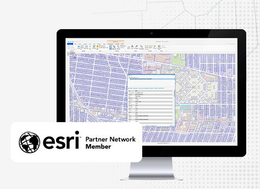
sign upAssessor Parcel Maps
View and Edit High Resolution Maps
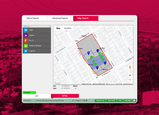
PQ Online assessor parcel maps are the clearest available, with even the smallest lot dimensions legible. Zoom, pan and customize maps, so they work even harder. All assessor maps are included – assessor map pages, book index maps and county-wide index maps – giving you the big picture options you need.
-
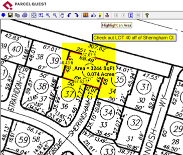
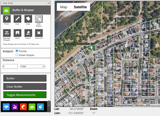
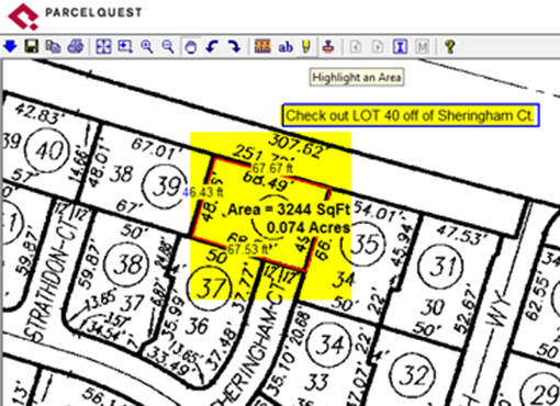
Measure & highlight
With ParcelQuest Online’s mapping tools you can trace around a parcel or any custom area and instantly calculate the acreage and lot dimensions. Use one or more colors to highlight multiple sections on a map.
-
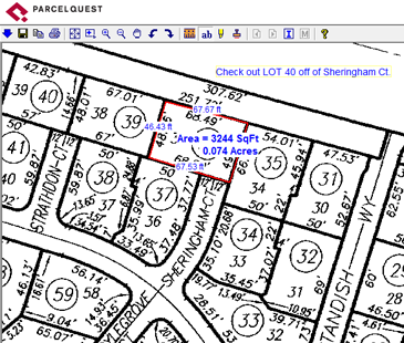
Add Text
Annotate maps using custom verbiage, change fonts and text size.
-
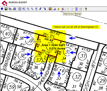
Add Arrows
Identify specific property features with various arrow markers.
Print, Save, & Export
Save entire customized maps or just the portions you need. Download as an image file, attach it to an email, print it, post it or use it in other documents. The world is your oyster. (Well, at least California is.)
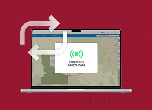
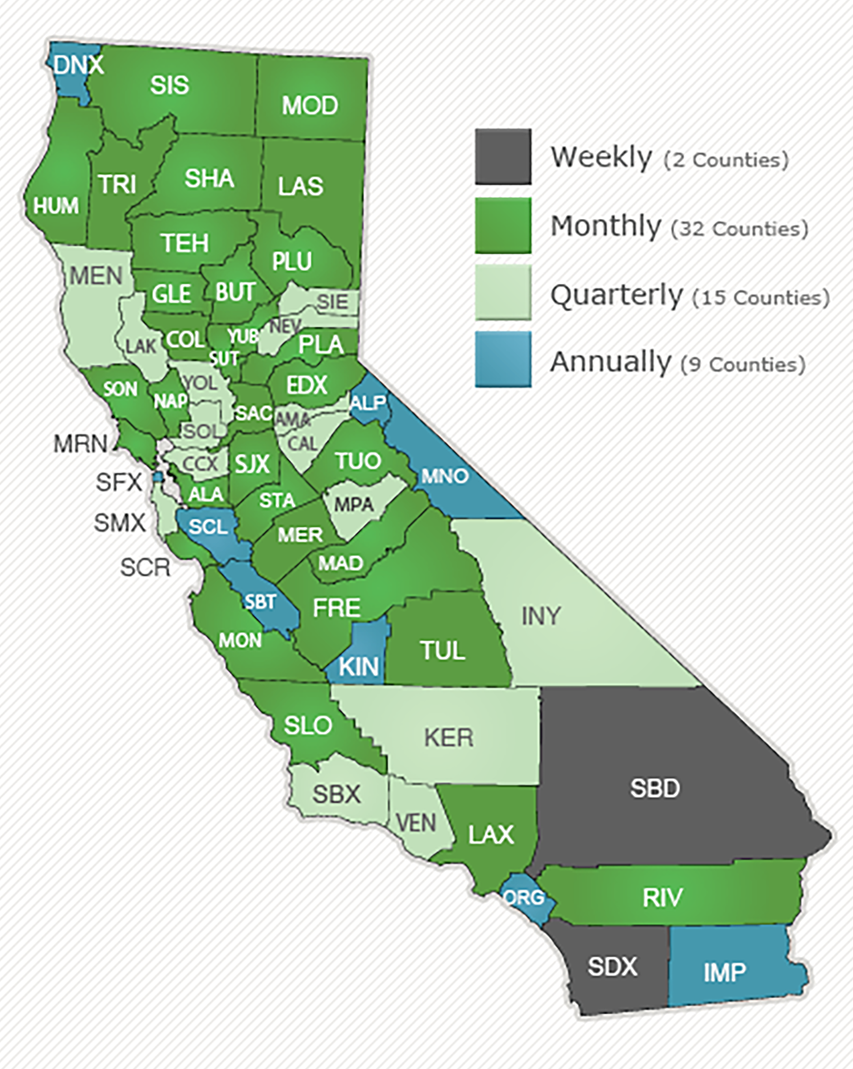
APN Map Update Frequency
Our California APN maps are the most current available. We update our assessor maps monthly in most counties, while often our competitors take a year or more to provide the same updates. This means you can see new subdivisions as soon as they’re developed, or see property splits, combinations, and lot line adjustments. Talk about Christmas in July. And August, and September…
Other Features
-

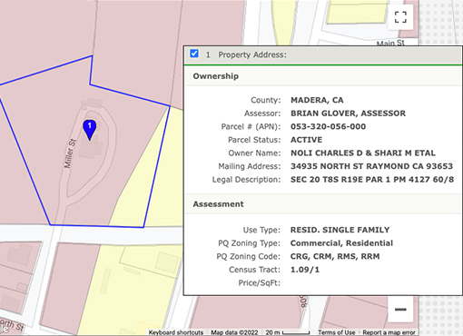
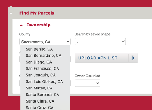
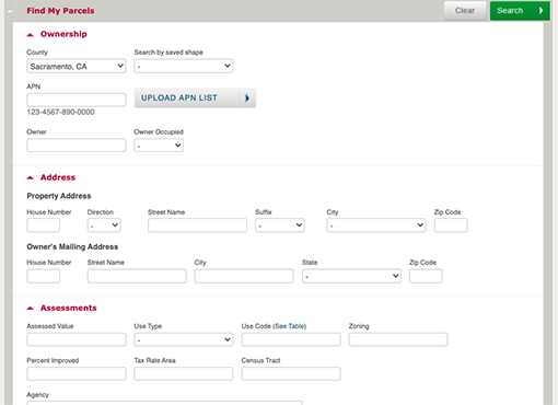
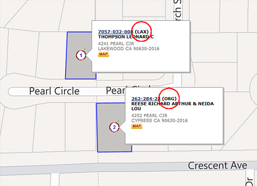
Parcel Search
Find all the property data you need with just an APN or address.
learn more → -

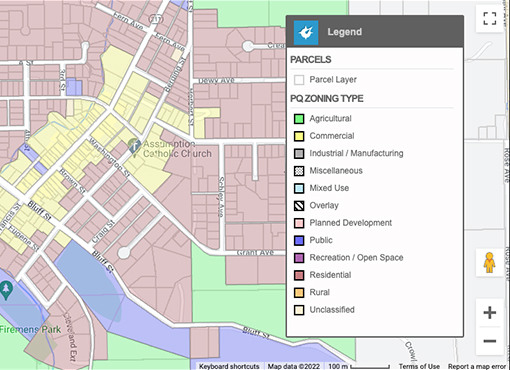
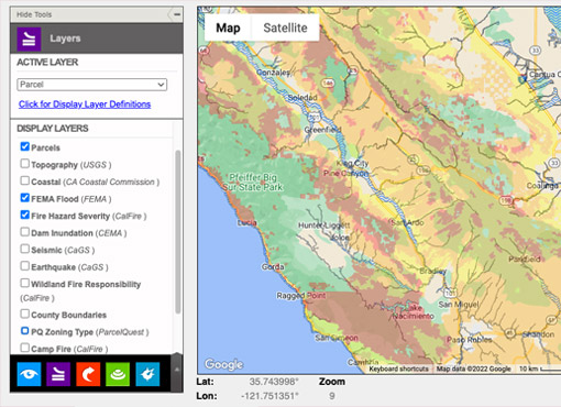
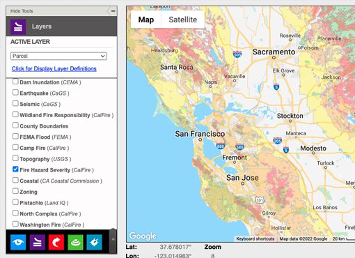
Area Maps & Visual Layers
See more of the data you need with street and area maps and a plethora of interactive visual layers. Use our drawing tools and buffer search to customize your maps quickly and easily.
learn more → -

Property Owners
Verify ownership data, addresses, and multiple properties with one click.
learn more →